coastMap
Helmholtz Centre Geesthacht Marine Model Analysis
coastMap is the marine Geoportal of the Institute of Coastal Research of the Helmholtz Centre Geesthacht (HZG), Germany. It combines analyses and model data on seafloor conditions with those in the water column above. Geographic focus is on the North Sea and the atmosphere. The portal offers campaign data, model analyses and biogeochemistry thematic maps. Users can freely select and visualize models covering remarkable amounts of geographic areas and time periods.
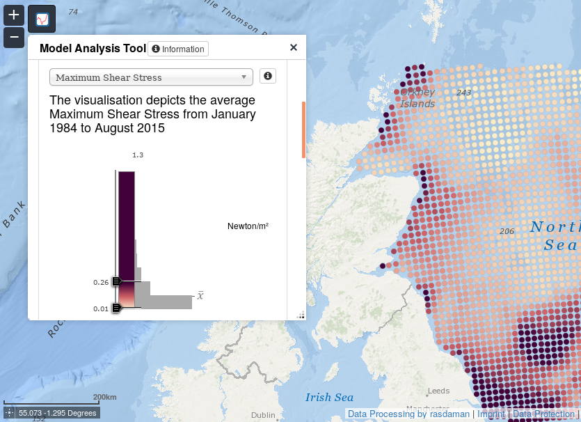
A wide variety of scenarios is freely accessible via the HZG Model Analysis Tool |
HZG has decided to use the rasdaman Big Data engine. This platform, which is completely based on open standards, complements coastMap with unified, flexible and scalable data management. Fast access and analysis of model data is provided via homogenized, user-friendly spatio-temporal datacubes. Altogether 190 datacubes are currently available in rasdaman and available open and free of cost. "rasdaman is an exciting technology for accessing and managing Big Data." says Dr. Ulrike Kleeberg from HZG.
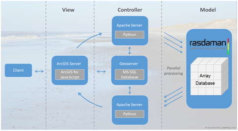
Homogenized data management based on datacubes builds a flexible platform enabling users of accessing data with standard tools. So rasdaman embedds itself seamlessly into HZG's existing IT-Infrastructure. |
Contact: